Well the big story in the KC Weather World is our soon to be next dose of summer like heat and humidity heading this way. We'll transition into that airmass tomorrow night and MON AM and you'll be feeling it MON and Tuesday.
This will be our second shot of heat. It seems like forever ago but we actually have been up to 91 this spring. Back on 4/3 with record highs that afternoon. Also we've had 2 days with highs of 87 on 4/9-10. So we've been there and we're going back for another couple of days. Monday I'm expecting highs in the upper 80s-90 and Tuesday near if not into the lower 90s. I first thought this might happen this past Wednesday and it looks like it will come about. The humidity will also be pretty high so for the first time this season the Heat Index will be approaching 95-100 or so as well. This should break on Wednesday at this point. That will depend on the progress of a cold front. The EURO seems to be on the flakey side over the last 3+ days so I'll be putting much of the forecast into the hands of the GFS ideas and massaging those thoughts.
The question for tomorrow is that the set-up is extremely favorable, when looking at the wind shear parameters, for severe weather. However I placed the storm chance at only 20% tomorrow and that is because before the heat and humidity get to overly impressive, yielding a very unstable atmosphere, the winds aloft will be bring in some VERY warm air and effectively capping off the atmosphere. This essentially means that as the atmosphere heats up and the air rises the CAP keeps the air from rising through it. This typically will suppress the vertical development of the cumulus clouds that form and you end up with a muggy day.
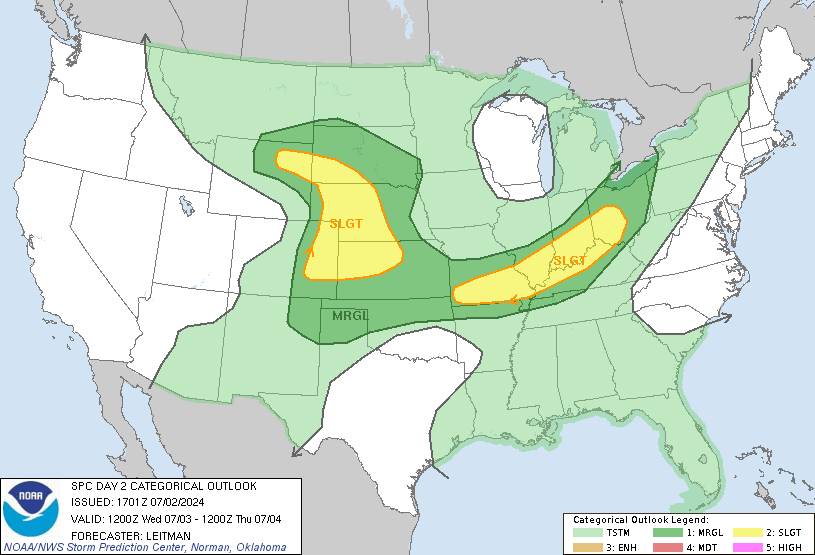
The models are very bullish on this cap making it here fast during the day tomorrow. Sometimes weird things can happen, but without any upper level storm to weaken the cap and with most of the features that would promote storm development nearest the surface and not aloft as well...it's going to be tough to generate storms. MON and TUE should follow suit as well for the vast majority of the viewing area. SPC is also on board with this thinking...take a look.
So after this small chance ends, then we'll focus on the heat and humidity. Let's go up to about 5000' or so and show you how the airmasses will be moving across the country. Notice the change from TUE to THU. The REDS/MAGENTAS represent the warmest colors and the blues the coolest.
First Monday...
Now Tuesday...
Now Wednesday...
and finally Thursday...note the substantial cooling moving through the area...
When this type of heat breaks during this time of year (really any tie of year) usually there are some big storms and severe weather. By later WED we'll be tracking a disturbance from the western part of the country...
This, taken at face value, would trigger a large outbreak of severe storms, mostly hail/wind producers (squall line) sometime later WED PM/night. We'd they be cooler and drier for Thursday. Forecasting severe weather from 5 days is is pretty iffy and there are many variable that could diminish our chances, i.e. a lead wave that creates rain/clouds earlier in the day, reducing our instability during the frontal passage. So it's by no means a slam dunk, but certainly something that needs to be watched. A quick look into the 12Z Euro, shows similarities by timing differences with the front some 12-24 hours slower in pushing through.
Regardless it will be cooling off substantially towards the end of the week! Have a great weekend.
Joe
ad


No comments:
Post a Comment