Well it tried to get close to here...but the warm front has just about stalled now some 75-100 miles south of the metro. Warmer air is flooding into the southern plains and reaches into S KS and S MO. It's 70 in Joplin now and 64 in Chanute...59 In Clinton, MO and 58 in Sedalia, while Whiteman AFB less than a county to the west is 43 degrees.
The front has not made much progress towards us and now the winds are switching back to the NE and that will enhance the cold air seeping at the surface into the area. While it's cold here at the surface, one look at the fascinating sounding data from Topeka this AM reveals that IF one were to go up in the atmosphere some 5000' or the equivalent of 4 or so Empire State Buildings...we'd find temperatures closer to 55 degrees on the top floor! Take a look at the sounding...the balloon, which goes up twice per day sends back temperature/wind/dewpoint information on it's journey into the sky before exploding. This sounding reveals how warm it is just above the surface. Also it shows, by looking at the temperature/dewpoint trace being on top of each other, a saturated atmosphere from the surface to about 3800'. The peak of the warmest air above that is at 4700 feet with temperatures near 55 degrees! Fascinating...click on this image to make it larger.
Anyway one can dream right.
Our weather, while foggy now with some light mist will be getting worse over the next 8 hours or so as t/storms are starting to get together across the southern plains...and are racing towards the NE. They should arrive before the evening is done with the potential for some decent rainfall. That chance combined with the melting snow and the saturated soils has resulted in a Flood Watch being issued for the metro and surrounding areas for tonight.
Here is a snapshot from the regional radar at around 12:30 showing the developing area of rainfall across SC KS...
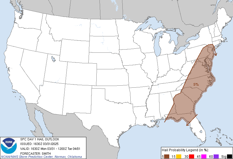
This area of rain will move parallel to the I-35 corridor and move into the region later today. The SPC seems rather gung ho on the potential of at least some marginal severe hail from this as it moves through...we'll see about that. While it's cold here on the ground the storms would be fueled by the warmth and moisture aloft, combined with air that will be spreading out aloft as well later today. This will result in stronger updrafts..Interesting to see they're placing our hail chances as high as some of the stronger storms in the MS River Valley.
Meanwhile check out the western sections of TX where the storm has generated strong surface winds of near or more than 50 MPH...this has resulted in the SW part of the state in creating a dry downslopewind off the mountains of SW TX, allowing the air to heat up and dry out. The dewpoint in Wink, TX is 0 degrees and combined with a temperature of 81 means the humidity is 5%! This is the driest air in the country now!
OK so now that that is covered what about the winter precip chances. Well they start to go up after midnight tonight through 4AM tomorrow. As the storm pulls towards the southeast of here, it'll drag down the colder air aloft to allow the atmosphere to create snow. Now it can't because it's so warm up there, but by about 3-5AM near KCI it will be cold enough for that to happen and that transition (sleet then snow) will sweep towards the SE as the storm pulls away rather rapidly after daybreak. The window for snow is small, based on the quick ejection of the storm, but a dusting to 2" is not out of the question from the metro northwards and areas up towards NC MO have a good chance of seeing a wintry mix transition to some heavier snow a few hours before us. That could allow a quick 2-5" accumulate towards the NE of the metro. I'll try and create some snowfall maps for the 5:30 news (after the race).
The quick moving storm will pull the moisture away tomorrow AM and we should be mostly sunny in the PM allowing temperatures to recover into the upper 30s and melt away the wet snow that may fall here before daybreak. The rest of the week looks good with highs in the 50s (Wednesday may be a bit cooler though). Next system is due in later FRI into SAT AM with another rain/snow scenario possible.
Big blog with a lot of weather!
Joe


No comments:
Post a Comment