Our weather over the next several days will certainly be a big subject of conversation. Starting this AM, there was a mess on the roads with dozens of accidents. This was caused by just a little freezing mist/drizzle that slowly developed in the saturated airmass that continues to grip the region and will do so for awhile. Combined with temperatures 20-25 degrees...it created slick and iffy driving conditions on all roads in the area, from bridges and overpasses to regular roads. A hat-tip this AM to our FOX 4 Morning Show Facebook fans for all the real-time road information that I used this morning...
We'll get to our weekend weather in a few minutes. MT was kind enough yesterday to put together a couple of winter weather graphics to show on the air. I thought I'd share them with you...this information was culled from a nice write-up from the NWS in Pleasant Hill that's available here.
Anyway, as I've stated for a couple of weeks, we're not done yet with winter and I still believe that as another strong storm will threaten the region later tomorrow and Monday.
That storm now is located in the SW. It's brought heavy rain to parts of central and southern CA and also the potential for snow near Los Angeles today. The NWS there has issued a variety of winter weather warnings for that part of the country.
Also notice how those warnings extend farther eastwards to AZ...
Several inches to 2 feet of snow is possible in these mountain areas...
This storm shows up nicely on the satellite pictures this afternoon.
The storm will become rather intense as it moves from the SW through the Southern Rockies and then towards the I-44 corridor. It's actually a rather good track for a significant snowstorm here. There is an issue though for our area to get that. Aloft we're going to be flooded by warm air...not a little warm air...a lot of warm air. Temperatures at 5000' will be in the 50s, and that warm air will work down towards the surface during the day tomorrow. With the snowmaking part of the atmosphere well back towards NE and central KS, it'll take awhile for us to get into that part of the storm. On the surface, the warmest air wll be south of here as a warm front will struggle to move through the area and in reality, may never make it. Take a look at the surface map tomorrow @ 6PM...
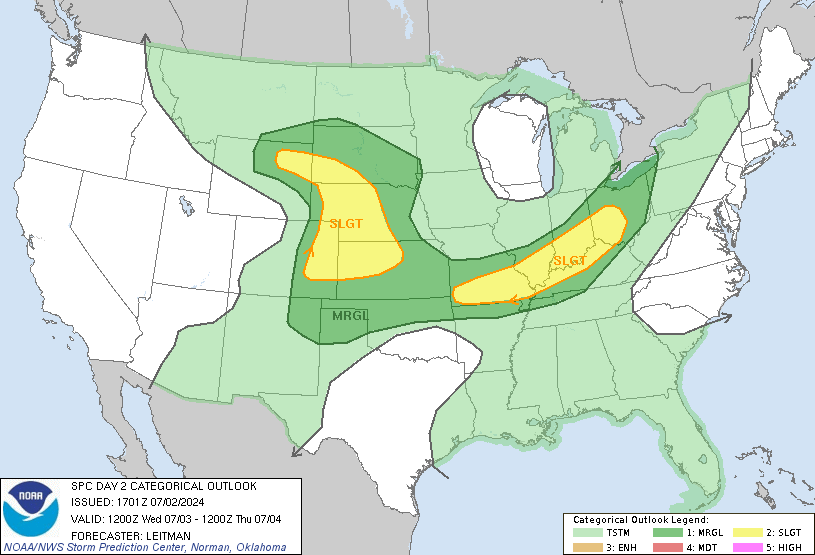
This storm will be very energetic, and south of here there will be a risk of severe weather in the more unstable air to the south of KC...these storms will then take off towards the NE...The SPC has put this area under a SLIGHT to MODERATE risk of severe weather...
A concern here would be if some storms can fire then go north of the warm front (we call it becoming elevated) these storms would then have the opportunity to create some marginal severe hail here (Quarter size or larger) Something to watch in the later PM tomorrow.
Then on Monday as the storm strengthens and moves east of here, it will tug in the colder part of the atmosphere that will be to the west/NW of here tomorrow. This may then convert the leftovers to some snow. Still iffy at this point though for accumulations.
The rest of the week looks OK with highs in the 40s and 50s with TUE and THU looking milder.
Joe


No comments:
Post a Comment